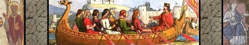

In Chapter Five of Strathclyde and the Anglo-Saxons in the Viking Age, I suggested that the battle of Brunanburh (AD 937) might have been fought somewhere in North Lancashire. I specifically highlighted Amounderness, the district between the rivers Lune and Ribble, as a possible ‘conflict zone’ containing the battlefield. Amounderness was a possession of the West Saxon king Athelstan, who granted it to the Archbishop of York in 934. Athelstan had previously purchased the territory for a considerable sum from landowners who were most likely of Viking stock.
I take the view that Amounderness was the most northwestern part of Athelstan’s ‘England’ at the time of the battle of Brunanburh. Beyond it lay Lonsdale – the valley of the Lune – and the future county of Westmorland (which I suspect was under the authority of Anglo-Scandinavian lords who answered to York rather than to Athelstan). Beyond Westmorland lay the southernmost territories of the ‘Cumbrians’ or Strathclyde Britons, whose king led one of the allied armies that faced Athelstan in 937.
A couple of sites within Amounderness have names similar to those attached to the battle by tenth-century chroniclers (Brunanburh, Brune, Brunandune, etc). One is Bruna Hill near Garstang, to which I pay special attention in my book, while another is Bourne Hill, near Thornton on the Fylde. The map below shows North Lancashire in the tenth century, with these two sites marked as green squares. Also shown are Roman roads, major rivers, the ecclesiastical centres at Heysham and Heversham, the Roman forts of Lancaster and Ribchester, and the presumed Anglo-Saxon burh at Penwortham.

The case for Bourne Hill has recently been re-stated by Mick Deakin in a paper that I recommend to anyone who has an interest in the Brunanburh campaign. Mick has been researching the geographical context of the battle for several years and has amassed a large amount of data. Having no axe to grind for a particular location he is able to approach the topic objectively, keeping an open mind and not fixating on one particular site. Like many people (including myself), he sees a number of flaws in the currently popular view that the battle was fought at Bromborough on the Wirral Peninsula. He has also considered the case for an east-of-Pennines location and remains unconvinced, in spite of strong arguments being put forward by Andrew Breeze and Michael Wood.
In past correspondence with Mick I’ve tended to show scepticism towards the Bourne Hill theory. My initial instinct told me that the Fylde seems too far west, too far from the beaten track (i.e. a major road running north-south) to be the conflict zone of 937. Having perused Mick’s paper a few times, I’m now inclined to be less sceptical. In fact, Mick identifies the main weakness in the case for Bruna Hill, a site that I must admit to feeling quite enthusiastic about after visiting it last year.
Update: October 2016 – Mick’s paper “The Quest for Brunanburh: The Fylde and the Hidden Identity of Bourne Hill” was originally linked from this blogpost but the link is no longer active (i.e. the paper is no longer available at Mick’s page on Academia.edu).
* * * * * * *


Reblogged this on Senchus.
LikeLike
I am intrigued by the possibility of Bourne/Burn Hill for the Battle of Brunanburh, further west than I had thought for an Amounderness location in your argument–I was looking more at the land roads for troop movements north-south and wonder how or why they might fight a battle on what looks like a peninsula.
It is hard to tell, at least on GoogleEarth, where the hill is/was due to extensive industrialization and other buildings. It is also hard to know what the waterways were like for those who might be arriving or departing by sea.
However, my maiden name is Bourne….
LikeLike
Yes, the area is so developed that it’s difficult to imagine how things looked 1000 years ago. A useful article on the ancient landscape is Richard Watson ‘Viking-Age Amounderness: a reconsideration’, pp.123-41 in N. Higham & M.Ryan (eds) Place-names, language and the Anglo-Saxon landscape (2011). I don’t have a copy of this – just some scribbled notes – so I can’t recall what Watson says about waterways and seaways.
LikeLike
would love to read , however the link seems not to working alas !
LikeLiked by 1 person
Thank you Juliette for spotting the broken link. I’ve now added a note at the end of the blogpost. Sadly, I cannot find an alternative online venue for Mick’s article.
LikeLike